
Walk a Muskogee Street by Address
Start with one complete address, then save the spelling exactly as it appears in the first record. In Muskogee, that location can lead to a parcel, a tax account, a recorded instrument, a historical directory entry, or a map reference. Each has a different purpose. An ownership name is not proof of occupancy, and an old directory appearance is evidence for that directory year only. The most useful street directory workflow preserves dates and identifiers before it compares names.
- Confirm the current mailing format with USPS, then retain the original form used by an older record.
- Use the Assessor or Treasurer route to note the situs, property or tax ID, owner or taxpayer, mailing address, and legal description separately.
- Compare the city atlas and ODOT county map when city limits or a county location could affect the result.
- Search the County Clerk index with the legal description, instrument number, book and page, or a party name when available.
- For a past household, check the library and OHS directory, newspaper, map, and probate leads for the same address and period.
A public voter portal is not an address-browse tool. Oklahoma’s individual lookup requires a name and date of birth, and protected voter records are excluded. Use it only for an appropriate individual verification, never to assemble a street list.
Keep Muskogee Street Fields Separate
Address research often goes wrong when fields with different meanings are merged. The Assessor describes the property, while the Treasurer exposes tax-roll results. A 2024 county tax packet, for example, includes an owner, a mailing address, a property ID, a location, a tax ID, and a legal description. Those are related facts, not interchangeable labels. The parcel’s situs or location identifies physical property; a mailing address tells where a notice was sent; and owner or taxpayer names are administrative associations.
- Parcel
- A county property unit identified by a property or tax ID. It can tie assessment and tax material together even when address formatting changes.
- Situs address
- The physical location carried in a property record. It is different from an owner’s mailing address.
- Plat
- A mapped subdivision or lot reference. Addition, block, and lot details can be more durable than a familiar street form.
- Criss-cross directory
- An address-arranged directory used to locate historic listings at a particular number and street. Its entry is period evidence, not a current roster.
Use the parcel or tax identifier as the link between county systems, then carry the dated street form with it. That practice makes a Muskogee street directory search easier to audit when a record uses a shortened city name, a directional abbreviation, or a subdivision description.
Search Muskogee Tax Records by Street
The Muskogee County Assessor is at 400 W Broadway, Room 210, and can be reached at 918-682-8781. Its page links to DataCrossPoint, although the dynamic Muskogee application did not expose a stable list of live search controls during research. The Treasurer’s OKTaxRolls search is a more clearly documented option for owner and tax-year work. If an online result is incomplete, the Assessor can provide a field card or copy and the Treasurer can help with the tax record.
| OKTaxRolls control | How it narrows a Muskogee record | Result information documented |
|---|---|---|
| Business or owner name | Searches an owner or business association | Owner name, property ID, and record type |
| Last name and first name | Separates a personal-name search | Tax year and tax ID |
| From and To Tax Year | Limits results to a selected year span | Base tax and total due |
| Unpaid-only control | Filters for a current tax-status view | Payment route where shown |
The tax search does not expose a ZIP-specific field. A total due is time-sensitive and can include penalties or fees, so it should not be used to infer a person’s conduct or connection to a street.
See the Muskogee OKTaxRolls search as it was captured for the available controls.
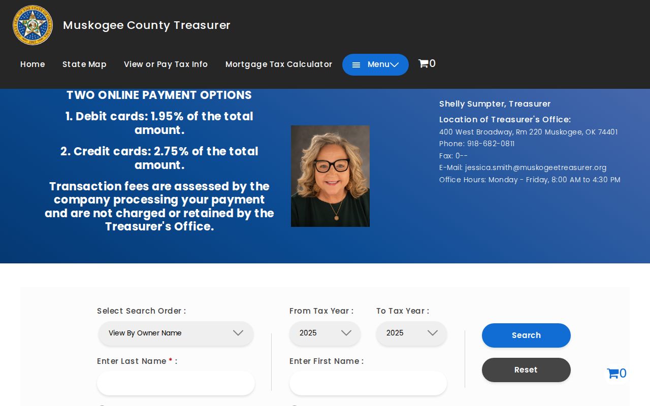
The screen supports a records-first street directory approach, but the final match still needs the parcel, legal description, and dates checked against the underlying record.
Read Muskogee Parcel Maps Carefully
Parcel mapping provides geographic context, not a list of people. The available ActDataScout interface is dynamic, so its exact live filters and labels were not verified from a stable capture. Its useful role is to orient the address, compare adjacent parcel identifiers, and carry a legal description into the Clerk’s index. For city-versus-county questions, cross-check the City atlas, which includes streets, blocks, utility and zoning layers and marks areas outside city limits, with the ODOT county map.
Use the Muskogee parcel-map interface as a location and parcel-context starting point.
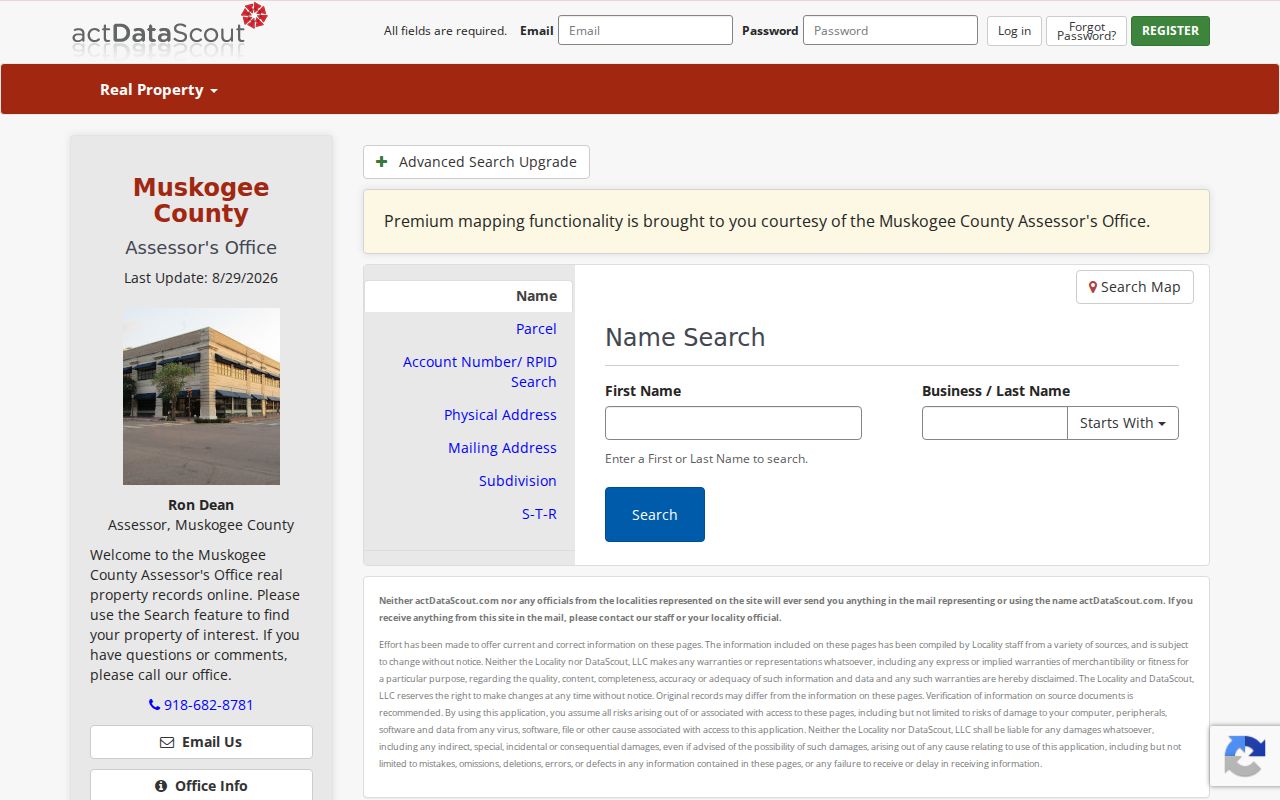
Because the live map did not yield a stable field inventory, record only the identifiers actually visible and confirm them at the Assessor or Clerk counter if a map label is unclear.
Read Muskogee Deeds Beside the Street
The County Clerk at 400 W Broadway records deeds and other instruments. Its Muskogee portal, OKCountyRecords, provides a basic name or business search and an Advanced Search route. The free index begins in November 1997, scanned images begin in January 1990, and the portal describes new records as posting in real time. Images use a token or plan system. For older deeds, use the Clerk’s counter, copy route, microfilm, or OHS and townsite material rather than assuming an online gap means no record exists.
Advanced fields include name, book and page, instrument number, recorded-date range, legal description, quarter/section/township/range, and addition, block, and lot. These alternatives matter when street wording has changed. The County Clerk’s land-records help number is 918-682-7781, press 2. A photographic copy is listed at $1 per page and certification at $1; confirm current charges before ordering.
The portal’s inspected 2026 deed detail illustrates the fields worth preserving in a street research note: record type, instrument number, book and page range, recorded date and time, instrument date, grantor, grantee, legal description, filing fee, and image count. In that sample, the legal description used section, township, range, and quarter notation rather than a street address. The field list helps link a parcel to a recorded document without turning a party name into an occupancy claim.
Muskogee Street Records and Access
A street address is the shared starting point, but a street directory must show which custodian owns each record. The table below keeps the access channel and the evidence type visible. It also marks the point where online searching ends and a counter, written request, or historical collection becomes the better path.
| Address-keyed material | Muskogee custodian or source | What it can support | Access route |
|---|---|---|---|
| Parcel assessment and tax roll | Assessor and Treasurer | Situs, property ID, owner or taxpayer, mailing address, legal description | DataCrossPoint, OKTaxRolls, field card, or counter copy |
| Recorded deeds | County Clerk | Grantor, grantee, instrument, book/page, legal description, chronology | OKCountyRecords, Clerk counter, copy request, microfilm |
| Historic directory and newspaper listings | Muskogee Public Library and OHS | Period address and household or business clues | Library collection, remote copy request, OHS Research Center |
| Street and historical building context | City atlas, ODOT, LOC, and OHS | Jurisdiction, lot, street grid, and a dated building snapshot | City and state maps; November 1898 Sanborn item |
| City permits or code material | City Clerk or applicable city office | Specific address-and-date record if releasable | Request by address, date range, and record type |
There was no stable public citywide permit or code-enforcement search located in the research. Request a specific record series instead of asking staff to compile a resident list.
Search Muskogee Street Names Across Time
Historic searches need more than a modern address. The Oklahoma Historical Society home-history guide recommends trying a number both as digits and words, a spelled-out street and its abbreviation, and directions before or after the name. “N 2nd,” “North Second,” and an OCR variation can point to the same place. Preserve the source wording in a research note, then test a normalized version separately.
No official street-renumbering year or complete former-street list was located. That is a research gap, not a reason to invent a conversion. The November 1898 Library of Congress Sanborn set has seven Muskogee sheets and is a useful time slice for footprints, building material, use, lots, and streets. It cannot prove title or occupancy. Later local-year coverage was not verified.
Muskogee Street Directory Archive Route
For an address that predates the portal index, work from the library and OHS rather than repeating the modern query. The Grant Foreman Collection at Muskogee Public Library has more than 500 microfilm reels. The library reports city directories from 1903 to the present and newspapers from 1875 to the present. Its remote article-copy channel is MuskogeeHistory@eols.org, with a $10 research fee per request; give the address, approximate years, record type, and desired output.
OHS directory searching accepts City and Year and leads to material at the Research Center. Its documented telephone-directory reel runs include 1910; 1916 through 1922; 1924 through 1934; 1936 through 1948; 1949 through 1950; 1952 through 1954; and 1957 through 1959. Gaps are real. A directory match can place a person or business at an address in that edition, but it does not prove a continuous stay.
Request Muskogee Street Records Precisely
When a record is not online, state the property address, known parcel or legal description, record type, date range, preferred electronic format, and any known instrument or property ID. The Oklahoma Open Records Act calls for prompt, reasonable access but does not require an agency to create a new compilation. Ask for the underlying index, field card, deed, map, or permit record rather than a custom street report.
Keep a request log with the custodian, date sent, quoted fee, response, and a stable detail URL or book, reel, and page reference. The Clerk, Assessor, Treasurer, city office, library, and OHS each hold different pieces of a Muskogee address trail.
Muskogee Street Directory Privacy Limits
Street-based public records have firm boundaries. A deed shows parties to a transaction, not necessarily who lived at the location. A tax owner, trust, estate, or business may not be a natural person, and a mailing address may be elsewhere. Voter information has protected categories, including Address Confidentiality Program participants. Driver records, protected court files, and other restricted material should not be reconstructed from partial records.
Lawful use. Use Muskogee street records for personal history, family research, or civic context, and never to stalk, harass, or harm a person.
Check a Muskogee Street Match
Before treating two records as the same address, compare the street number and direction, city or county status, parcel or property ID, legal description, and the relevant dates. A deed should be compared by its instrument and recorded dates. A historical directory should be paired with a newspaper, census, cemetery, probate, or map lead from the same period. This second-source check is especially important where a lot has been renumbered, rebuilt, or described only by a subdivision reference.
For a backward address trail, use the deed chain and historical household process on the Past Residents page rather than treating the latest parcel record as the whole story.