
Muskogee Neighbors: Block Evidence
The defensible result is property adjacency, not a claim about a social relationship. Begin with the address and identify the lots that touch it or sit across the street. Then compare parcel identifiers, legal descriptions, and recorded instruments. Each source has a distinct role. A current tax or assessor record can provide parcel and ownership context; an old directory or Sanborn sheet can add dated context. None of those sources alone proves who is present at a location now.
| Source | What It Shows About a Block | Access |
|---|---|---|
| City atlas | Street grid, blocks, utilities, zoning, and labels outside city limits | City map sheet |
| ACT DataScout map | Potential adjacent-parcel context | Dynamic view; stable parcel capture was not located |
| County Clerk index | Recorded instruments, grantor/grantee trail, and legal-description clues | Index begins November 1997; images begin January 1990 |
| 1898 Sanborn item | Historic building, lot, street, and use context | Seven-sheet historical snapshot |
| NBN civic directory | Community-group leads | Not membership, household, or boundary proof |
The Muskogee County Assessor and Treasurer are useful next checks once a parcel is known. A tax-roll owner or deed party is not automatically the occupant, and an owner mailing address is not automatically the property’s situs. Keep owner, taxpayer, grantor, grantee, mailing recipient, and occupant as separate labels. If the target needs a city-versus-county check, use the atlas and county map before treating a Muskogee mailing address as proof of city residency.
Muskogee Parcel Adjacency Process
Start parcel-first. The city atlas can establish the street, block, and apparent city-limit context; the dynamic ACT DataScout Muskogee map may help reveal adjacent parcels, though the research did not capture a stable view with an exact field set. Use the map as a locating aid, then carry the parcel identifier or legal description to the Assessor, tax roll, and County Clerk. That order avoids turning an address match into an unsupported claim about people who live nearby.
- Find the address on the city atlas or parcel map and record the street, lot or adjacent-parcel reference, and city-limit context.
- List the parcels that touch or face the target. Preserve each parcel ID, legal description, and the date of the display.
- Compare assessment or tax information with the County Clerk’s recorded-instrument index, keeping deed parties separate from a possible occupant.
- Use a Sanborn sheet, directory, or newspaper only to add a dated historical layer, then cite that layer by year and page.
The County Clerk’s office page identifies it as the local land-record custodian. Its online index reports data from November 1997 and scanned images from January 1990. Older instruments may require the counter, microfilm, or historical collections. For a full named-street trail instead of the immediate block, use the Muskogee by-street directory.
Legal descriptions can be more stable than a street number when a historic address is unclear. Preserve the addition, block, lot, or quarter-section wording exactly as shown, along with book, page, instrument number, instrument date, and recording date when available. A deed can join an owner trail to the correct parcel, but it does not establish that a grantor or grantee lived there. That distinction keeps the search tied to property evidence.
Muskogee Atlas and County Lines
Parcel adjacency should be checked against geography, not just a postal address. The City of Muskogee atlas sheet shows streets including Paul, Norman, Gordon, Washington, and Park, as well as blocks, utility layers, zoning, and areas marked outside city limits. The ODOT county map adds county roads, municipalities, and larger water and transport features. A city mailing name, ZIP, assessor display, and municipal boundary can point to different geographic scopes.
Use both maps when a block seems close to the city edge. Record which map supplied each boundary observation and its date. The map does not establish ownership or current occupancy. It simply helps prevent an address in Muskogee County from being described as a parcel within the City of Muskogee without support.
Note: ZIP service is postal geography, so it should be retained as an address fact rather than used as a city-limit decision.
Muskogee Historical Block Time Slices
Historic evidence can answer a different question: what did this block look like at a particular time? The verified November 1898 Muskogee Sanborn item has seven sheets and is a public-domain fire-insurance map. It can show a building footprint, material, street, lot, and labeled use. It cannot prove title, identify every occupant, or stand in for a current parcel card. Treat it as a date-stamped snapshot and compare the source year to the other record dates.
For later household clues, the library’s city directories and newspapers can provide a name, address form, role, or relationship reference. Search an old street both as a numeral and in words, and vary direction and street abbreviations. When an address changes, preserve the raw historic form beside a normalized search version. A multi-unit building may have several directory listings even if the parcel record has one owner.
Muskogee Civic Directory Context
Community directories can provide a route to public civic context, but they do not identify a block’s private membership or boundaries. The NBN civic and fraternal directory lists organizations such as Shrine, Blue Star Mothers, CASA, Civitan, Eagles, Lions, NAACP, and Rotary. Those listings are leads for community activity. They do not show who belongs, where a group’s boundary lies, or whether people on nearby parcels know one another.
| Community source | Useful context | What it cannot establish |
|---|---|---|
| NBN civic/fraternal directory | Publicly listed community-organization leads | Private membership or household presence |
| City planning analysis | Historic and planning-area names | Current association boundaries or official status |
| County Election Board | Individual election-administration questions | A public block-by-block resident roster |
The NBN directory source is the documented civic lead for this research.
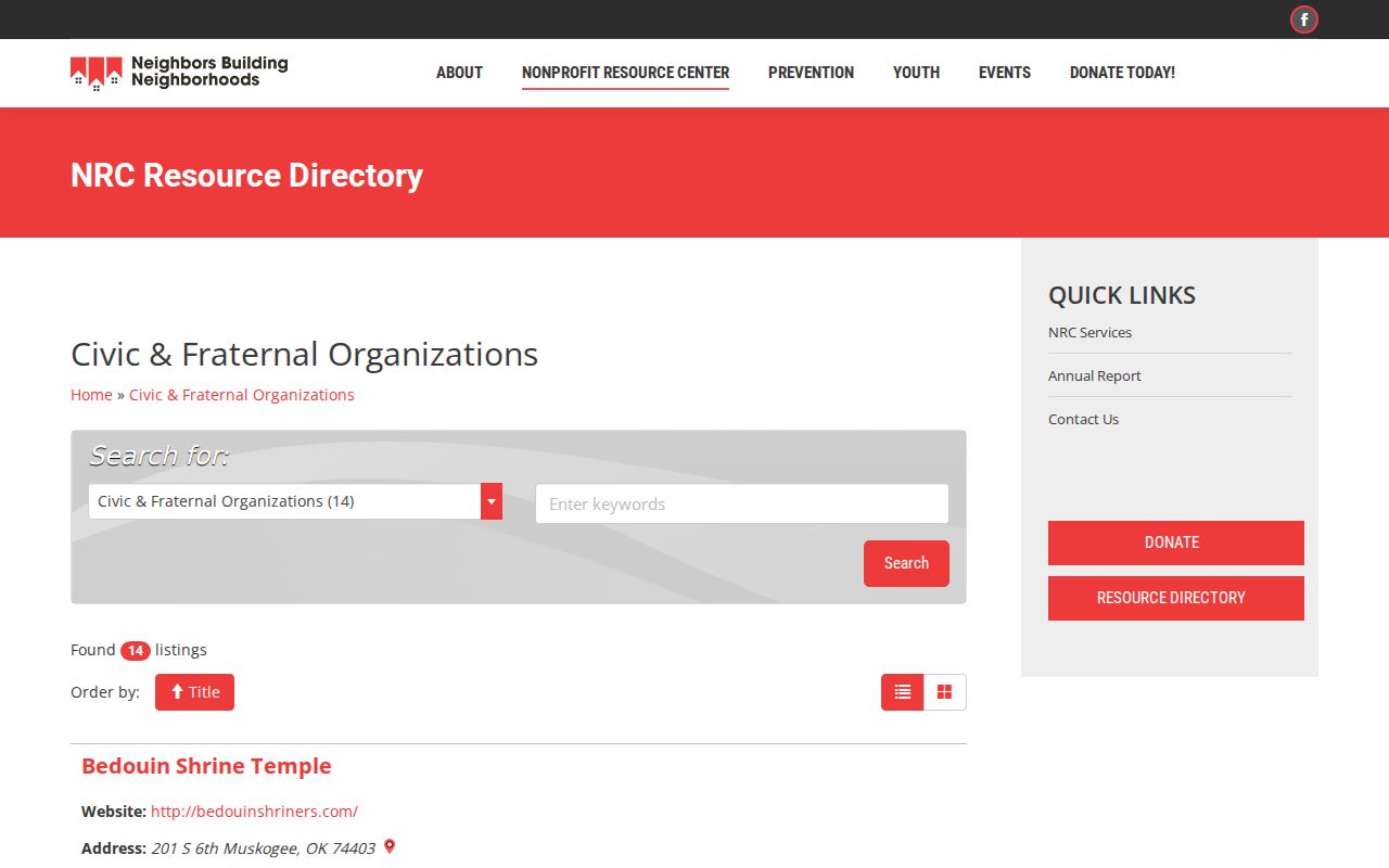
The directory view should be read as a community-resource list, not as a verified neighborhood-association directory or a list of people connected to a property.
Muskogee Planning Area Context
Muskogee’s 2019 planning-area analysis documents Founders’ Place, Kendall Place, Downtown, Depot & Freight, the Y district, Sadler, and Bacone as historic or planning-area context. These names can help orient a block in a historical or planning document. They are not an official current neighborhood-association directory, and their reported lines should not be recast as permanent legal boundaries.
Preserve the source and purpose beside the name. A preservation survey, planning report, postal route, census tract, school boundary, and local usage can draw different outlines. For a narrow property question, the useful record remains the parcel, legal description, and recorded instrument. The planning label provides context only.
Muskogee Voter Lookup Boundaries
The public Oklahoma Voter Portal is an individual lookup. It requests last name, first name, and date of birth. Research did not find a county selector, street-browse control, voter-ID lookup, or public sort for that form. The portal can assist with a lawful individual verification or civic geography question, but it cannot be used to browse everyone on a Muskogee block. A full voter-data route has requester qualifications and access controls; it is not a workaround for the public form.
Restricted voter records and Address Confidentiality Program locations are excluded from public reconstruction. A registration status or returned-mail event is administrative information, not proof of current presence or a finding about a person. Questions about an individual registration or polling place belong with the Muskogee County Election Board.
Muskogee Neighbor Records Compared
Official records identify their custodian, date, and scope. Commercial compiled-record products may combine information from several sources, but they may not show a source date, a complete record, or a clear distinction between owner and occupant. Neither category turns parcel proximity into evidence of a personal relationship. The best comparison is a dated official record and a second independent source, not a longer list of names.
| Category | Strength | Limit for a Muskogee block |
|---|---|---|
| Official parcel, tax, and deed records | Custodian, identifier, and recorded or assessment context | May show owner or party, not current occupant |
| Historic maps and directories | Dated street and building context | Historical time slice, not present proof |
| Commercial compiled-record category | May offer broad leads | Source, date, accuracy, and lawful-use limits may be unclear |
Muskogee Neighbor Lookup Limits
Oklahoma’s Open Records Act, 51 O.S. §§24A.1-24A.31, supports prompt, reasonable access to records that a custodian holds. It does not require a custodian to create a new custom report or an address-based roster. A public index can also contain an old value, a transcription error, or a match for a different person. Do not try to bridge gaps with protected voter information, confidential addresses, sealed material, or a collection of unrelated personal details.
The Oklahoma Address Confidentiality Program supplies a substitute mailing address and mail forwarding for qualifying participants. Protected voter categories also have restrictions. Their locations must never be inferred from parcels, historical directories, court references, or a map. Keep the result to the property relationship that the source actually shows, with a source URL, access date, identifier, and any unresolved conflict.
Lawful use. Use this research for personal, lawful property or historical context. Never use it to stalk, harass, intimidate, or locate a protected person.
Note: A clear parcel boundary is useful evidence, but it does not establish a household, a friendship, or present occupancy.